
Dispatch 16, June 21, 2019
The night in Glendive, and the cold medicine have me feeling much better this morning. We eat breakfast in the hotel, load everything in the car, and jump in… only to drive across the road. Sitting on a corner within rock-throwing distance of our hotel are two museums we can’t pass up: The Frontier Gateway Museum and the Glendive Dinosaur & Fossil Museum.
Frontier Gateway is open, so we visit there first. This little museum has a huge number of displays for such a modest place: old trucks and tractors, taxidermy, furniture, firearms, dresses, ceramics, fossils, cameras, a recreated newsroom, and tons more. The place is packed with interesting artifacts.
The thing I found most interesting, however, is a triceratops nose horn. This fossil has to be at least two feet long and must be 28-inches in diameter at the big end. Like rhinos, these plant eaters must have been extremely dangerous to annoy. And for you gun guys out there: if you ever get a chance, you’re going to need something a lot bigger than a 416 Rigby.
Next is the Glendive Dinosaur & Fossil Museum, right next door. These folks have a very nice facility that is based on biblical teachings. A T-Rex and an Allosaurus (I think) do battle in a rotunda. Plesiosaurs and Mosasaurs swim diorama seas. And skeletal models of many other animals, all constructed in life size, give you a cold feeling of what it might have been like to stand or swim among these real life monsters before the impact at Chicxulub altered history. I’m not certain about the validity of the Ica carvings of men riding dinosaurs, but then I’m not qualified to judge either side.
We climb aboard the Cadillactica and push on eastward crossing into North Dakota and arriving at Theodore Roosevelt National Park about mid day.

Theodore Roosevelt first arrived here in 1883 to hunt Bison. The following year his mother and his wife died, and he needed time to recover. So he returned to this area’s wide open spaces and peaceful vastness to become a rancher. Here, among the incredible vistas and wild animals, he healed himself, and more. His ranching efforts failed but this beautiful land ignited his ideas for conservation and preservation. When he became president (1901-1909), Roosevelt put into law many of those ideas. He established the The U. S. Forest Service, and signed the National Antiquities Act which proclaimed 18 national monuments. He worked with congress to establish five national parks, 150 national forests, and many national reserves, protecting more than 230 million acres.

There are two parts of Theodore Roosevelt National Park: North and South Units. We visit the South Unit first.

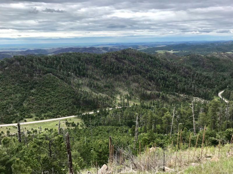
We enter the park at Medora, now a quaint little tourist town near the south entrance if the South Unit. The time of year the town is bustling with visitors. However, the park is huge with plenty of room for guests. We travel along Scenic Loop Drive, near the Little Missouri River, stopping at nearly every feature and overlook. Surprisingly, so some of the old log buildings are still standing at Peaceful Valley Ranch.

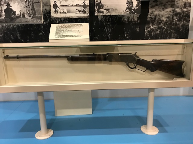
Roosevelt’s Winchester 40-60 ranch rifle.
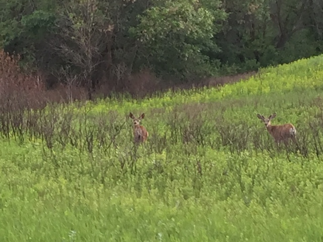
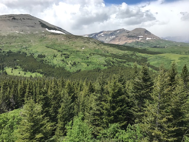
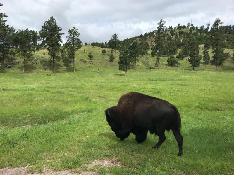
Bison graze, mule deer glide elegantly, and prairie dogs fuss at us and scurry to their holes. The farther we go along the road, the more scenic it becomes. The wind is howling as I climb to the top of one of the towering mounds to get pictures. I can barely stand up in the wind. Sometimes you see almost nothing but grass and prairie dog towns, next deeply eroded canyon lands, and next breathtaking vistas where you can see for 30 miles or more.
We tour along Scenic Loop Drive as far as possible, but the road here, as it was in Glacier National is under repair from winter damage near the completion of the loop, and we have to drive back the way we came. Now we are running late. We grab a late lunch in Medora and head off for the North Unit 68 miles away.
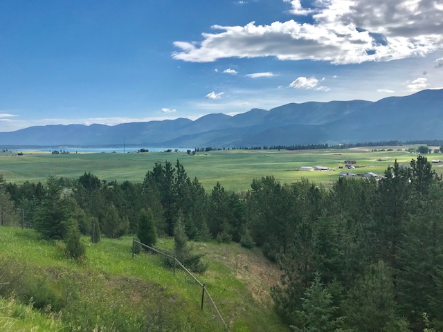
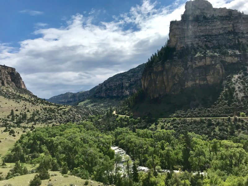
The North unit is not visited as much by the public as the South. The Little Missouri passes through this park as well. So the eroded badlands are bisected by green swaths of grass and trees, as if this place is in a quandary about what it wants to be. If anything, it is even more beautiful.
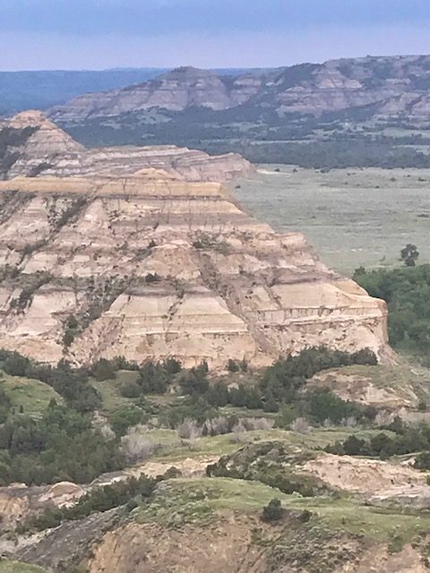
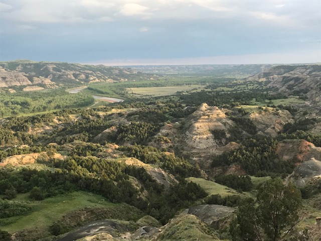

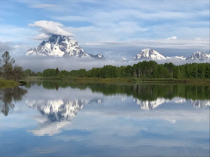
Again we stop at every overlook (and for buffalo crossing the road) and arrive at Oxbow Overlook as the sun is setting. It is late and almost no one is in the park now, so we have it mostly to ourselves. Whatever you think of the photographs attached, I can assure you that they don’t do this place justice. What a tribute to our best-known sportsman president!
We arrive at our hotel in Dickenson at 10:30, and I work on this until 1:00 am.
Dispatch 15, June 20, Glendive, Montana
We load up the Cadillactica and leave our Glacier National Park cabins with a bit of sadness. How do you say goodbye to one of the most beautiful, romantic places on the planet? Besides, I caught my first ever Lake Trout here. This is where we turn east and begin the long looping trip back home.

This morning, we are off to Glendive, Montana where we’ll spend the night and continue on with our sights set on the Theodore Roosevelt National Park on the other side of the state. So it’ll be a day of hard driving. We can see rain squalls in the distance.
Mike sets the cruise control of the Cadillactica for light speed and we blast through cattle country, which consists of rolling green hills, with the occasional splotch of badlands thrown in. It may have a sameness, but is beautiful at the same time. Very few homes on millions of acres. Very little traffic. This is what the political cognoscenti call “fly over country.” We see not one Pronghorn, though there must be some hiding in the bowls, and only a few muddy creeks and rivers. As the Battlecar eats up the miles, and I stare out the portholes sitting on air conditioned leather seats, I can’t help but think of those who passed by here before us: the Native Americans traveling on foot, Lewis and Clark in their dugout canoes and riverboats, the first settlers in oxen or mule-powered Conestoga wagons, and how hard it must have been to travel so far.
Our first stop on the way to the Theodore Roosevelt National Park is at our second Lewis & Clark Natural Historic Trail Interpretive Center in Great Falls, Montana.


A huge, intricate compass adorns the entryway of this Lewis & Clark Center.
This one is a low Adobe-colored structure where the landscaping consists of more than 40 species of natural plant life that you’d find in the area. No mowed lawns here. At first, the grounds look unkempt, but then the whole picture grows on you. First, because it has a basement that is open to the lower side of the slope the facility sits on, it’s much larger than it appears when you first view it. And the center gets more impressive once you are inside. Dioramas of animals, the Shoshone, Nez Perce, Salish, Blackfeet, Clatsop, and Crow Native Americans that the Corps Of Discovery met and depended on, the equipment they carried, including firearms like the famous air rifle they used. A 28-minute film introduces the explorer’s travels through Indian country. It even has a life-size model of the group struggling to drag a heavy dugout canoe up a very steep slope. You’ll leave with a new appreciation for what these explorers accomplished.


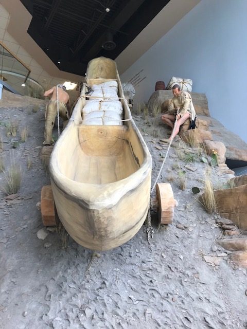
Life size replica of the Corps Of Discovery’s struggles.
We spend far too much time with Lewis & Clark, so we fire up the Warp Drive on the Cadillactica and blast off. The wind is howling as we pass through open, green cattle country, then sandstone canyons and mesas.
We drive for miles and miles finally stopping at the cleanest rest stop in the entire United States. Outside is a sign with a warning about this planet’s past, and perhaps a cautionary one about its future:
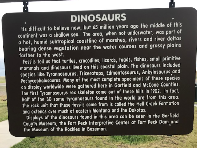
Sixty-five million years ago parts of this place were under the Great Inland Sea. This is dinosaur country.
We climb back aboard and are off again. I’m afraid to look at the speedometer.
The miles click by. This cold has me down and I’m about to fall asleep. Okay, I dozed off for just a few minutes there. I was dreaming about hunting dinosaurs with that big rifle in one of those Jurassic Park movies when we pull up to our hotel in Glendive. Mike says something about me not really cutting it as Sulu. Lord, do we really have to unload all this stuff again? I’m too tired to eat so I take two pills and go to bed.
Dispatch 14, June 20, 2019, Rising Sun Motor Lodge, Glacier National Park, Montana
Lack of cell and data service in this area is frustrating at times because I can’t get my images and copy to gee-haw like they should. And emailing them to Sporting Classics Editor, Larry Chesney, is something of a nightmare because the only really good wifi or cell service spot is 18 miles from our cabin, over near Babb. Push the “Send” button and sometimes the copy goes. Sometimes the images go. Sometimes neither go. Oh well, that’s the price of traveling through Paradise.
This morning we eat a hearty breakfast at the Rising Sun Restaurant. I can’t say enough good about the fine staff. The servers are fast, attentive, engaging, and very courteous. Jason Lee is one of those Jack of All Trades that has an answer for every possible question and makes you feel like his long lost cousin. I hope I get to fish with him one day.

Check out Red Eagle Mountain, which looms outside the restaurant’s glass windows. Nothing like eating bacon and eggs, drinking coffee, and looking for Mountain Goats and Grizzlies roaming the precipitous ledges and grassy slopes far, far above you.
After breakfast we set off to explore the east side of Glacier National Park by first traveling west on Going-To-The-Sun Road to the point before Logan’s Pass where the road is blocked for repairs just as it was on the west side.
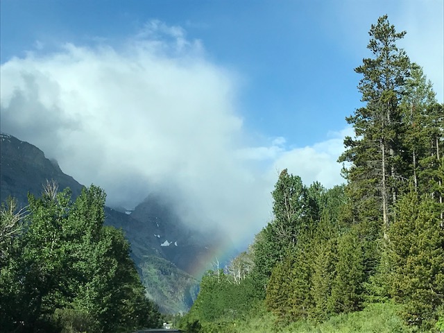
I took this shot right through the Cadillactica’s windshield. There was another rainbow off to my right as well.
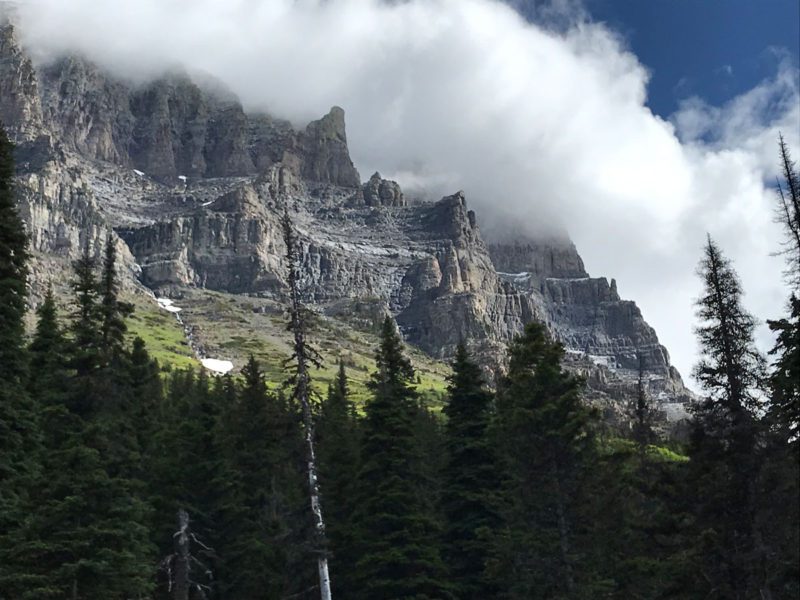
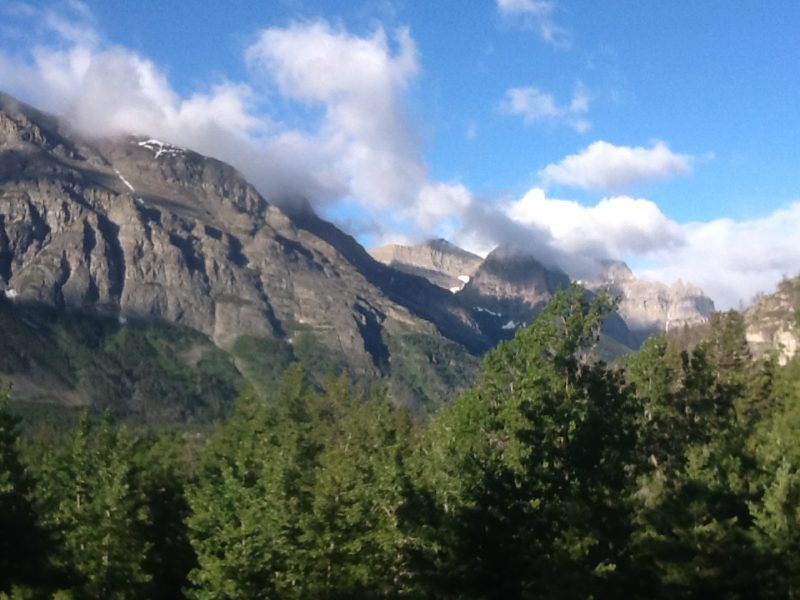
A rainbow foreshadows our journey. And the road climbs ever upward. The farther we go, the better it gets. In fact, it occurs to me that the scenery gets so good, you can’t capture it with a camera. You have to see it. “George Bird Grinnell, cofounder of the Audubon Society, named this place, “The Crown of the Continent,” in 1908. 111 years later, that’s still true.

Clouds begin to darken the sky. Then it starts to sleet and snow. Yes, on June 20th! But the weather here changes faster than anywhere else I’ve ever been, including Alaska. The ice fall soon stops, leaving a sugar coating that glitters in the intermittent sun on the higher elevations. The sun returns illuminating the undulating terrain and giving depth to the images. Occasionally, that morning light makes its way through the living trees and the standing black-barked forest, damaged in the 2015 Reynolds Fire, to light up Beargrass. The flowers, blooms, or whatever you botanists call them, look like lightbulbs glowing against the dark trunks and green, new growth.

Beargrass growing along Going-To-The-Sun road.
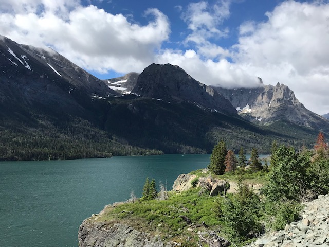
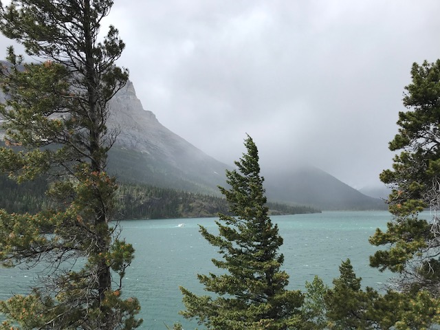
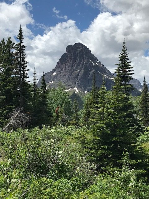
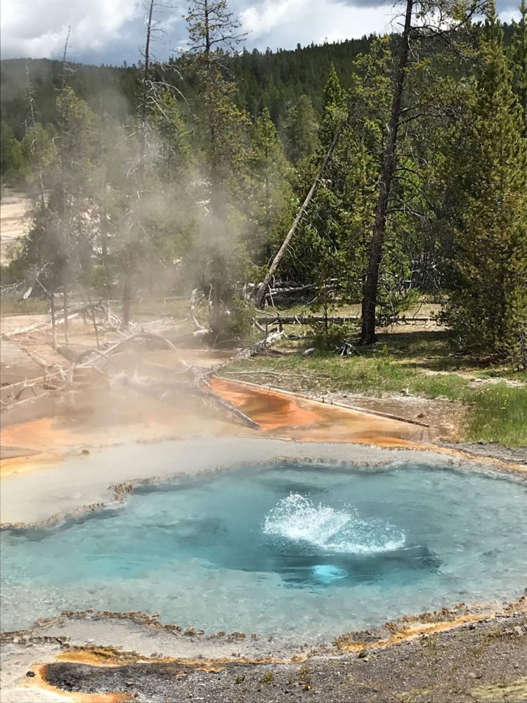
We pass Sun Point and Sunrift Gorge where views become visions. I have no idea how to describe this place. Words don’t. Photographs don’t. Maybe listening to music would help.
All of the following images were taken near Sunrift Gorge up to Jackson Glacier Overlook where we are forced to turn around and head back.
We leave this portion of the park, drive down from Rising Sun to the park entrance at Saint Mary. We turn north on highway 89 toward Babb, passing Lower Saint Mary Lake on our left. Near Babb we re-enter the Glacier National Park going west toward Many Glacier. The road here is in bad shape and Mike is dodging potholes and what I think are frost heaves from this past winter. Here, that was last week.

Swift Current creek, then Lake Sherburn are on out left as we climb up toward Many Glacier. The water flows from still lakes, to roaring rapids which pass through walled canyons of layered stone.
We eat lunch at Many Glacier Lodge, which has architecture inspired by the traditional lodges of Switzerland. They even have little red crosses adorning the room doors. We buy tourist T-shirts. Swiftcurrent Lake behind the lodge offers a stupendous, clear view of mountainous rock formations from the hotel’s patio. It is awe inspiring.
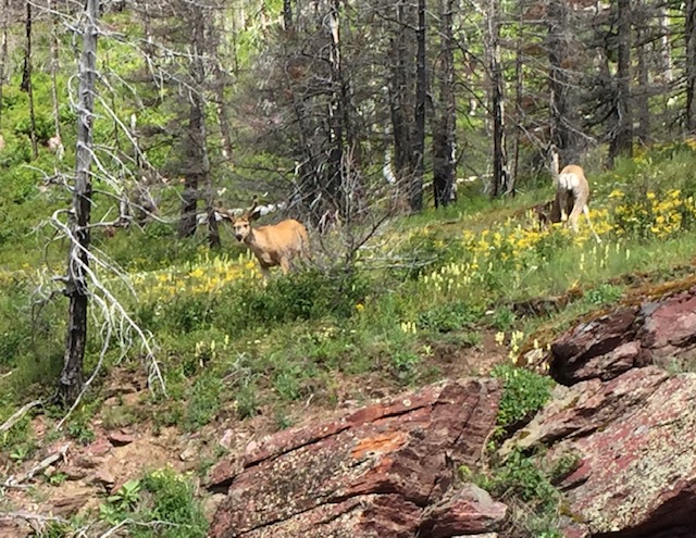
On the way down we see two mule deer, as well as a couple of elk bulls in velvet grazing above the roadway. They seemed unimpressed by the Cadillactica, or the loads of German tourists bailing out of their vans to take photos.
We are all tired from the driving, neck-twisting, road hazard dodging, hiking, and climbing in and out of the Cadillactica to get photos, so we head back to the cabins for a rest. It’s about 4:00 pm and I’ve got a nasty cold. I drift off for an hour or so and wake up at almost 6:00.
Since this part of the park is suppose to get snow tonight and we are leaving tomorrow anyway, after getting rained out at Henry’s Lake, I’m thinking I’ll give the fishing one more try. So I assemble my rod and reel, tie on a wooly booger, and walk downhill toward Saint Mary Lake. I have no idea what I’m doing, where to go, or what to fish with. “This is going to require some luck,” I think.
I walk down the long, paved drive and wander through a picnic area to where I can see the edge of Saint Mary Lake through thick trees. Rose Creek flows from behind our cabin, under a bridge and into Mary Lake just above the picnic area. So thinking like the mostly Bass fisherman that I am, I want to make a few casts into the outflow of Rose. I pass an ominous bear warning sign, fight through the bushes, and find myself at the edge of this beautiful, but brutally wind-blown lake. I’m having to hold on to my new hat. Red Eagle mountain towers ominously in front of me. Have I come this far, to miss the fish again?
I make a few casts and get tangled in the overhanging trees. So I move farther down, crossing a small bridge and fight my way through the brush to a sand, gravel, and rock spit that juts out into the lake on the west side of Rose Creek. Now the clouds are spitting a cold rain which is driven harder by the stiff breeze. I’m freezing. But I cast anyway, first into the creek, letting the wooly booger flow into the lake as realistically as possible. Nothing.

This is where I’m fishing.
I see a dark area far out in the lake, but still within the outflow. With the wind to my back I cast my line as far out as I possibly can toward it. With the help of the wind, the fly falls right in the middle of the dark spot. And I get what I think is a hit. But I’m not certain. I cast again. This time I’ve got one one on. I scream, “yes,” to the top of my lungs, as the fish fights for its life. I reel in a bright, slim, forked-tailed Lake Trout about 18 inches long. I’m thinking that I’ve got to get a photo, or none of my old fishing buddies will believe me. I’m fumbling around with fish, rod, line, and camera. The wind blows my hat off, but I catch it. I put the fish on a rock to get the photo but it comes loose from the line. I take a couple of fruitless photos, but it quickly flops back into the water, and is gone.

Well, I did get this one image. See if you can make him out.
Dispatch 13, June 17, 2019, Glacier National Park Day Two, Montana
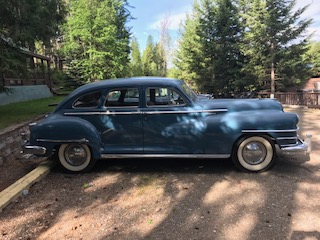
We eat breakfast near our cabin which is located across from the West Entrance to Glacier National Park. Curiously, parked nearby is a 1940s vintage Chrysler exactly like the one my grandfather owned when I was a young boy. Same color, same interior, same suicide doors. Because it had a semi-automatic transmission, that Chrysler wasone of the cars that my grandparents used to teach me how to drive. We used it to travel down to various landings along the Santee River in South Carolina where we’d rent a boat and fish for Bass, Bream, and Stripers. I’d love to know where the one in front of me came from, but we need to stick with our schedule. And, just as in hunting or fishing there is no such thing as a ten minute discussion about cars.
Before we leave the western side of the park we want to take Going-To-The-Sun Road as far east as possible. Normally, this road completely traverses east to west through Logan’s Pass bisecting the park into north and south sections. Right now, however, this important road is being repaired, and a 15-mile section in the middle is blocked until June 22nd, the day we need leave this area. We enter the park and pass long, narrow, Lake McDonald on the left, then McDonald Falls at the head of the lake. We stop and take dozens of photographs of the flowing water when I notice a warning.

Falls at the head of Lake McDonald.


Intermittent clouds and sunshine create ever-changing light patterns on the lake, river, forest, and mountains. If you don’t like what you see in your camera lens, just stand still for a few minutes and the scenery will take on an entirely different look. A stiff, cool breeze has put chop on Lake McDonald and run most of the swimmers and boaters away. We reach the blocked portion of Going-To-The-Sun Road, turn around, and begin the long drive around the southern part of the park. On our way to the East Entrance and Saint Mary, where Pat, Mike, Merrie and I have cabins reserved for the next two nights, the weather turns much cooler.
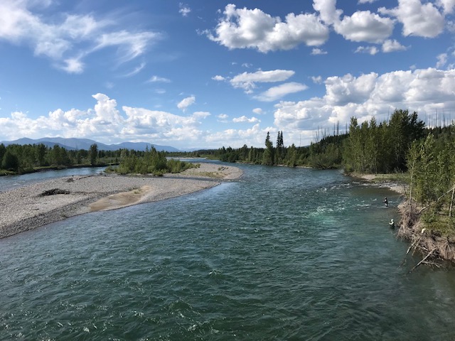
We follow highway 2 which runs along side railroad tracks which, in turn, run along side the Middle Fork of the Flathead, designated a “Wild And Scenic” river system. From our car windows we watch passenger and freight trains ride the rails along canyon walls below us as people below that ride rafts down the river. Everyone’s views are different, but beautiful.
Just beyond a place called Goat Lick, Highway 2 turns from south east to north east and goes through Maria’s Pass at 5,220 feet. Following the railroad and Bear Creek, we reach East Glacier Park and the Two Medicine River. We follow Highway 40 past the Lower Two Medicine Lake to a point near Upper Two Medicine Lake.
Near Two Medicine Lake.
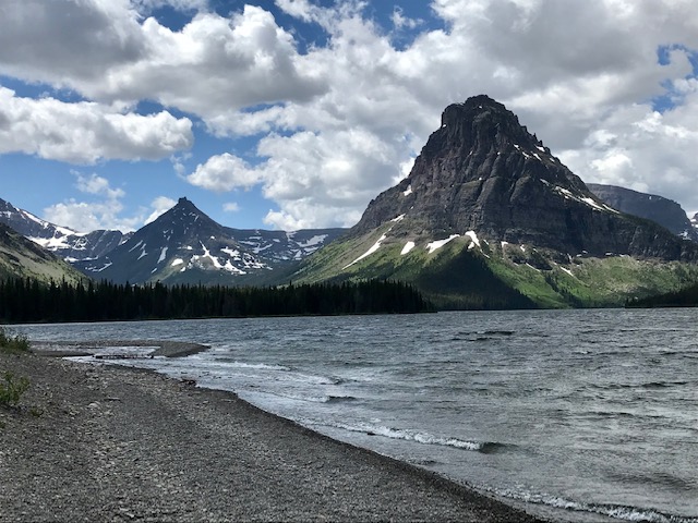
Two Medicine Lake is surrounded in part by jagged peaks that look almost new.
We turn north and take very scenic Highway 49 to Kiowa where we turn back west on hIghway 89 toward Saint Mary’s.
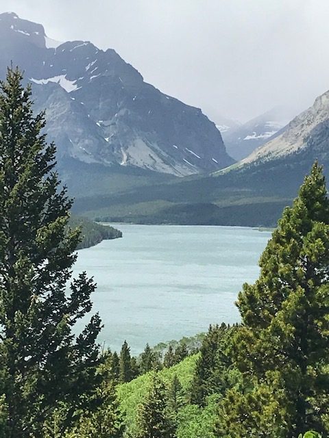
View of Two Medicine Lake from Highway 89.
Forests along Highway 89.
Seventy-one species of animals live within the boundary of the park. They include Pronghorn, Whitetail deer, Mule deer, Elk, Moose, Caribou, Bighorn sheep, Mountain goat, and American Bison.
We finally reach Rising Sun Motor Inn near Saint Mary where we’ll spent the next few days exploring the park and our nights in tiny duplex cabins. These cabins were constructed in the very early 1940s. Notice they are framed on the outside. The cabins are comfortable, but not fancy at all. No TV, no internet, no telephone service. I suppose we’ll just have to talk to each other the way they did years ago!
During the war years of 1943 to 1945 all the facilities of Glacier National Park were closed, with the exception of Rising Sun.
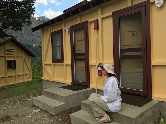
Merrie sitting on our cabin’s stoop admiring the incredibly beautiful view.
View of mountains from near our cabin at Rising Sun Motor Lodge & Cabins.
Dispatch 12, June 17, 2019, Glacier National Park, Montana
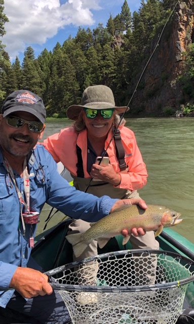
We’re eating breakfast in a hotel in Missoula, Montana and meet a very nice group of folks loading into trucks pulling boats. They are on their way to fly fish the Blackfoot River 10 miles east of Missoula for Cutthroat, Browns and Rainbows. Years ago they’d been classmates at Stienert High School in New Jersey. They are about my age, so I resist asking them to sing their old high school alma mater. Excited about being together on the adventure, they reminded me a lot of my own high school graduating class.

Guide Russ Laughlin, Joe Steinert, Susan Cirullo, Carl Smith, Susan Forrest, and on the right, Montana Hunting Fishing Adventures owner, James Mitchell. You can reach James at: 406-360-7238.
James called me later and said they’d already caught a nice 17-inch trout!
Leaving Missoula, we enter the Flathead Indian Reservation where we can see the Mission Range off to our right, with the Swan Range just behind. On the other side of that is the Lolo National Forest, and the Continental Divide.

We pass through Saint Ignatius, Montana and reach the bottom of Flathead Lake. Here, about 15,000 years ago, a glacier pushed its way south, scraping slowly down the Rocky Mountain Trench. The glacier broke into two branches at the Northern end of the Mission Mountains. The western side scraped and pushed the earth until the planet warmed enough to end the ice age. The glacier then began to melt, leaving a terminal moraine, the gravel hill that I’m standing on to take this photo. The Glacier’s ice continued to melt forming Flathead, the largest lake in the western United States.
These two locals seemed to be having a heated discussion outside of a store along highway 35. Something about politics. Not sure who was winning the argument, but we thought it best to pay for our snacks quickly and continue our journey to the Glacier National Park area.
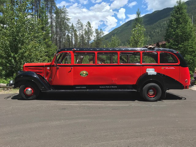
Very cool bus at Apgar Village. Maybe we’ll give one a try tomorrow.
Since it’s too early to check in to our rooms, we enter the Glacier National Park at the West Entrance, and stop at Apgar Village to learn about the park and get maps. We set the Cadillactica and our phones’ navigation systems for Polebridge. There we find a country store with all the trinkets a tourist could possibly want. Merrie buys a 50 cent banana.
Then we get lost. Somehow we wind our way up a rough dirt road to within eight miles of Canada. We’ve driven almost 3,000 miles and managed to get lost at the very farthest point from home. Isn’t that the way it always is: when you need technology the most, you find yourself out of cell phone or data range? Did someone pack a sextant?
We find a Park Ranger who is very helpful, patiently answers all our questions, and puts us on the right trajectory to get to our hotel before nightfall. On the way back we see two fishermen wading Bowman Creek and giving us hope that over the next couple of days we’ll find a guide that can help us land a few of these western fish.
Tomorrow, we explore the rest of the park!
Dispatch 11, June 17, 2019, Missoula, Montana

No, this is not a caldera coming to life, just morning fog near the Madison River. Note to Sporting Classics staff: I’ll be back before you can say, “Oh no, those Thursday Morning Meetings again!”
We put the cabin on Henry’s Lake in the Cadillactica’s rear view mirror, and take off for Glacier National Park. Because it’s quite a long drive, we’ll spend the night in Missoula, Montana before proceeding on northward. Before this trip, I’d never set foot in Montana, Idaho, or Nebraska. Now, I’m down to only three bucket list states: Hawaii, Connecticut, and Rhode Island. They’ll have a very high bar to match what I see outside the Cadilactica’s windows, however.
For the second time on this trip, we enter Montana, and ride for miles alongside the famous Madison River. The scenery is incredible. Everywhere there is a damp spot beside the road I see fly fishermen. They are fishing, untangling leaders, patching waders, congregating in breakfast joints, or just standing around camper shell-covered pickups telling fish… Well, I’ll be polite and call them, “stories.” Attached to the trucks are trailers loaded with banana-shaped McKenzie River Drift Boats. These are serious sportsmen. And while the left and right coast might view this place as,“fly-over country,” it certainly is trophy sportsman country. Every town of any size has at least a few tackle and sporting goods shops, restaurants and businesses which feature elk, moose, bear, and deer-like names. The outdoors are big in big sky country.
We pass Bear Tooth Lodge & Fly Shop, cross Indian Creek, and then into an expanse of rolling open land which appears as if it might feature glacial moraines. I’m no geologist, but if one of you experts knows, I’d appreciate an email: duncan@sportingclassics.com.
Plentiful Pronghorn in small groups graze the grass of these open areas, oblivious to signs like the one I see that reads, “EARTHQUAKE LAKE,” or another, “QUAKE LAKE” which give us humans fair warning that this place is tectonically active, and ever-changing.
At 9:30 we arrive in Ennis and look for a place to eat breakfast. Entirely by accident, we pull up in right in front of Yesterday’s Soda Fountain & Restaurant. I’m usually attracted to low, nondescript, concrete buildings for breakfast, as I think the concrete must impart some secret ingredient to coffee and eggs, but we are all hungry, so this wood sided structure will have to do. Lucky us.
We climb down out of the Cadillactica and in next to us pulls one of the finest pickup truck wannabes ever. This might be the only Geo Metro pickup truck on the planet. Can I get one of these in 4WD?

Katherine Ball, who has worked for five years at Yesterday’s Soda Fountain & Restaurant wins The Best Waitress (Server for you PC types) Award for the first half of The Great Western Loop Tour. And her employer, Yesterday’s Restaurant, wins The Best Breakfast Award, especially for the money. Mine was $7.95, and I had two eggs, real ham, hash browns, and toast.
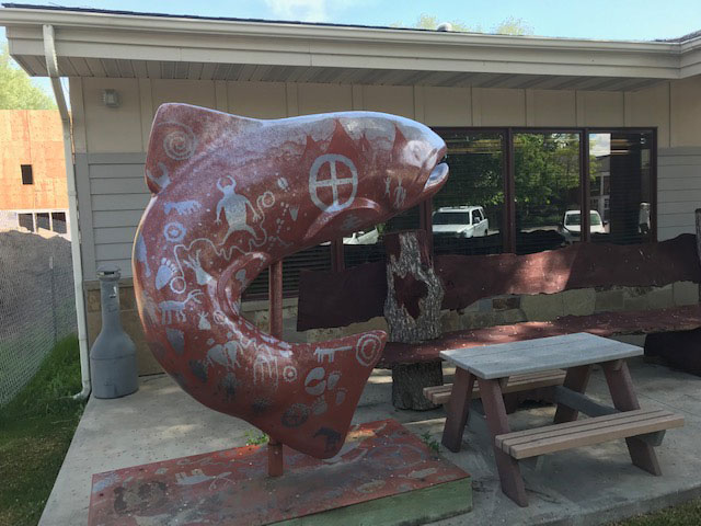
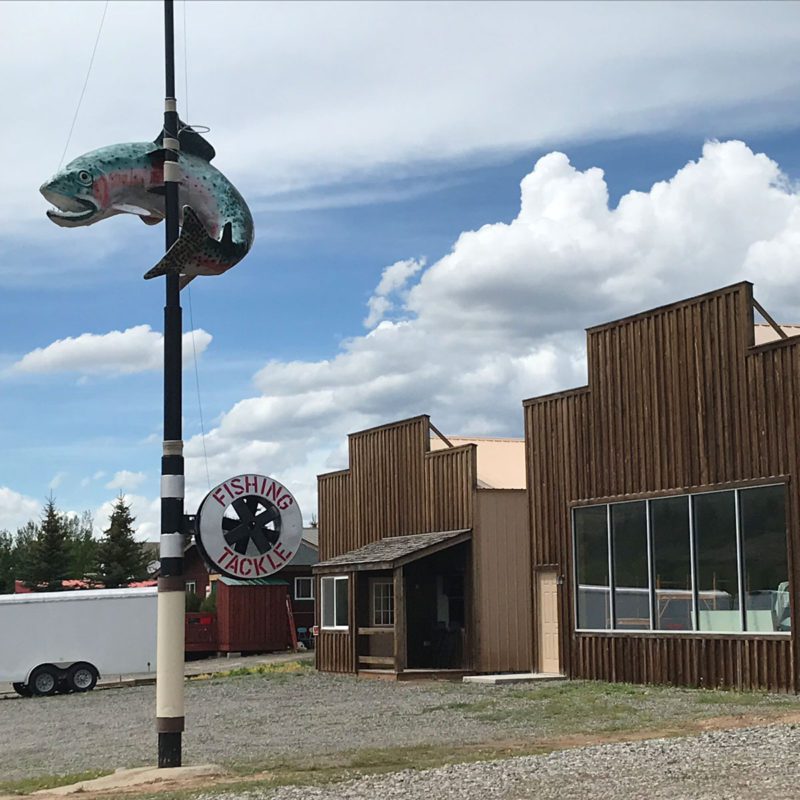
So how rabid are folks around here about fishing? Even the library in Ennis features a leaping trout. This one is complete with petroglyphs. Didn’t catch who sculpted it, but it sure is impressive.
I finally got my old, disabled iPad fixed by the nice folks at Simply Mac here in Missoula. Now I have a real working keyboard and a screen that I can actually see again! Larry, I’m still counting on you to edit out my misspellings, bad punctuation and grammar, and make me look impressive.
Tomorrow, we continue northward to Glacier National Park.
Dispatch 10, July 16, 2019, Fathers Day
We eat breakfast at Last Chance Bar & Grill, part of Trouthunter Lodge, then go next door to get licenses, a few flies, and an intermediate fly line for my 7/8 rod.
Out back, in the Buffalo River, it’s opening day, and everyone is catching fish while I’m eating a big breakfast. Since this is Father’s Day all the guides are booked. So our plan is to rent a boat and fish Henry’s this afternoon.

Finally got to use my Art Carter Reel that Ken Able built years ago. It worked great. Just wish I’d landed a big one for Art.
I get to use one of the Ken Able reels he made for us as a memorial to old friend and partner Art Carter. It has Art’s image engraved on one side. Part of the Sporting Classics family, Art passed away in 2003. He’d have loved this area around Henry’s Lake.
The guys in Trouthunter Fly Shop are very helpful. They even loan me one of their iMac Computers to try to resuscitate my iPad so I can compose these Dispatches without the errors I get from using the tiny keypad on my phone.

View of the Buffalo River from the patio of Trouthunter Lodge’s Last Chance Bar & Grill.
After 38 years at Sporting Classics, I’m finally fishing Henry’s Lake!
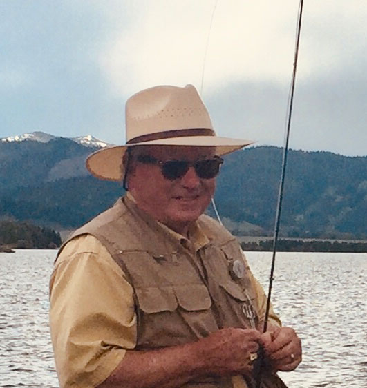
At Mammoth Hot Springs in Yellowstone I’d sunburned the daylights out of my already red face. So I bought myself a new wide-brimmed straw hat. My first Stetson came two days too late but at least it’s keeping the sun off now.
But there is no sun. After only a few minutes, a heavy, thundering cloud rumbles over the mountain to the west of us. So it’s cloudy, windy, and threatening rain. In fact, in this photograph Merrie captures me untangling my tippet just before a cold downpour runs us, first to cover, then back to our cabin. My new Stetson gets wet. I sit inside the cabin and brood. No reason to rent a boat until this clears up.
A cold rain descends on Henry’s Lake dampening my, and brother-in-law Mike Dukes’s, big trout dreams.
It does not clear up. I take a nap, wake up and brood some more. It doesn’t get dark here until around 9 pm, so maybe later?
Later we drive the ten miles back to Last Chance for dinner, where we learn everyone has been catching fish. Of course, now the sun is out. Or maybe over here it was out all along?
We finish dinner and drive the ten miles back to Jarrod’s. When we arrive at the resort, the temperature has fallen like a lead-filled sink tip. The sun is dropping fast too, and carrying my chances of catching a Henry’s trout with it. Tomorrow morning we have to leave for Glacier National Park.
I grab my rod, hurry down to the marina, and out on the breakwater to make a few casts. For fishermen, there’s always hope. Right?
I cast and cast to no avail. Nothing. Not even a hit. But I don’t give up and continue casting until the cloud-covered sun appears to have fallen below the peaks to the west. “Time to quit,” I say to myself, and begin winding fly line onto the Able.
It’s very late when I see the swirl. It’s out at my casting distance limit. I’m thinking, “whatever that is, it’s huge.” I twist my shoulder and upper body sharply to the right loading the rod, then launch a long, long cast. Miraculously, the fly lands in exactly the right spot, the fly line arrow straight. “It’s not up to me now, I’ve done my best,” I tell myself.
My fly line lurches to the left and for a nano second I feel her. She seems to have brushed the fly or the line in order to determine if it’s real. Before she leaves, however, I feel her weight, pushing, testing, learning. Satisfied, she is gone.

Sure, I’m disappointed. But I stare up at the dark mountains looming in the distance, think about all the things we’ve seen on this trip so far, and am very thankful that I even got the chance.
June 15, 2019, Dispatch 9, Henry’s Lake, Idaho
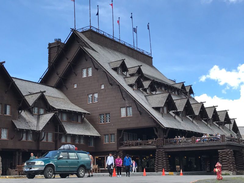
We spend a restful night then enjoy breakfast at the Old Faithful Inn in the northwest corner of Wyoming. This place is an iconic representation of the classic American Lodge.
Construction on the inn was begun in 1903, and it welcomed its first guests in 1904. Harsh winters, earthquakes, and the fires of 1988 have done nothing to dampen its spirit.
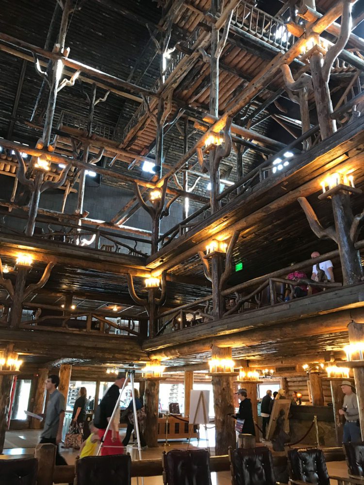
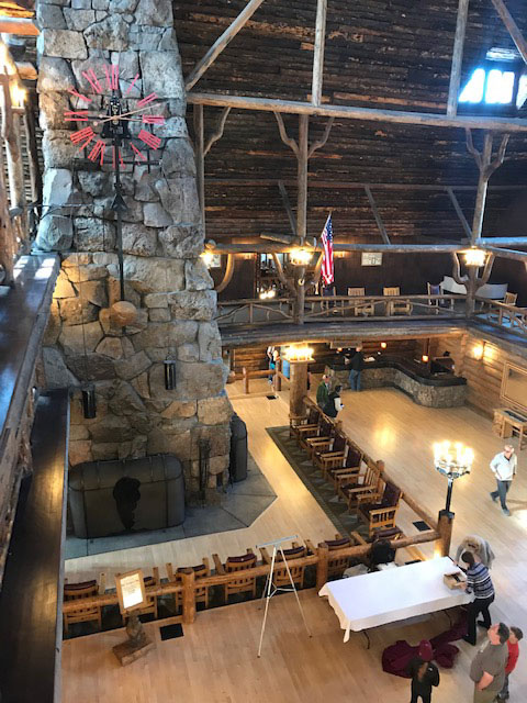
Part of the lobby of Old Faithful Inn soars 76-feet, 6 inches high. Or, as Robert Reamer, the lodge’s Ohio architect put it, “the height of the Lodgepole Pines that it is built from.” The logs came from a site four miles to the south of the Inn.
Five hundred tons of rhyolite rock, mined five miles away, were used to construct the massive four-fireplace chimney (notice the huge clock with its swinging pendulum). Reamer’s goal was to bring the great outdoors inside for guests. He certainly pulled that off. This place is every bit as impressive as the lands surrounding it.
A couple of secrets: the builders made very realistic but fake knot holes in the log walls so folks could hide secret messages within.
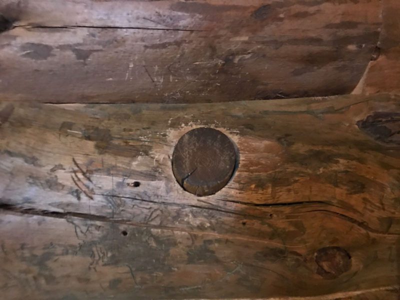
Orne of the workers left his name and the date inscribed high on a log wall. It appears to read, “Melvin Campbell 1903.”
If you are visiting the area, be sure not to miss Old Faithful Inn.
By way of Highway 20, we leave Yellowstone in Wyoming and enter West Yellowstone in Montana. Incredibly long lines of Fathers Day Weekend traffic are building up as we travel west toward Henry’s Lake.
We leave Yellowstone humbled by its vistas, dumbfounded by its geology, and mystified by its existence. Change is its only constant. And I feel lucky, and grateful, to have set foot here.
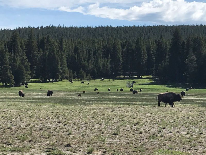
Buffalo are out in the meadows in droves this morning. We see many new calves nursing their mothers.
At Jacklin’s Fly Shop in West Yellowstone, I talk with the famous Bob Jacklin, and the nearly famous Dave Konieczny, both fly fishing experts. These are the kinds of helpful people we meet all along our way. Since fishing conditions change rapidly, Bob and Dave give us valuable information on other tackle shops that are closer to our destination.
We drive on up to Henry’s Lake and Jared’s Wild Rose Ranch, Marina, Camping, Convenience Store, RV Park, Arcade, Hot Tub, Cabins, Rooms, Boat Rentals, and Restaurant.
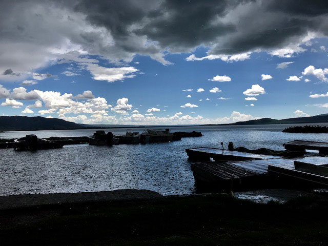
Henry’s Lake. Tomorrow, Mike and I will rent a boat and try to catch a trout with this view surrounding us.

The marina at Jared’s
I spoke with Gary Gumar and wife Brenda from Idaho Falls after they docked their rented boat. They caught four fish and are going to cook them on Fathers Day.

Photo of Gary Gumaer with trout he caught on the Snake River.
Fisherman, Biologist, C. J. Earl is here with his wife Britany. Her grandfather fished Henry’s from the time he was young. This is their first time back since he passed away.
This place used to be Wild Rose Ranch, founded in the 1800’s by William Bowers. So some of the cabins are over a hundred years old. Zane Grey stayed here, fished, and wrote parts of his novels from these same cabins
Merrie and I are staying in the old, but newly renovated, Mail Cabin, once a stage coach and Pony Express central mail hub.
It’s 11:26 pm here, so I’m off to bed. Wish me luck with the fishing tomorrow!
June 14, 2019, Dispatch 8, Old Faithful Inn, Yellowstone, Wyoming
Yesterday was a very long day, with spotty cell and data service. We didn’t get in our rooms until after 10 pm, completely worn out. I’m just now getting a chance to write things down.
We left Togwotee At 7:30 am with the Grand Tetons in the windshield of the Cadillactica. Describing the beauty of these ragged peaks is fruitless, so a picture being worth a thousand words, here’s at least 900:
When we left home in South Carolina the temperature was in the 90s. Up here, it’s in the 50s. And snow from last week’s storm covers the ground in high elevations.
Outside of Yellowstone, at a Snake River crossing, I speak with A. J, Martin, a fly fisherman from the Tri-Cities area of East Tennessee. He is fishing near a bridge with his wife, Karen. A.J. gives me a few pointers on angling the area, showing me two of the flies he uses most. I leave him a copy of Sporting Classics and wish him good luck.
Traveling along Highway 191, we pass Lewis Lake, named after Meriwether Lewis, who passed north of here on his return trip from the Pacific in 1806. Cow Elk graze along side the road. They seem entirely uninterested in us. Then, we crest the continental divide at 7988 feet above sea level.

At 10 am we arrive at the iconic Old Faithful Inn where the Geyser erupts not quite as accurately as it did before the 1988 earthquake.
We stay at the Inn just long enough to get photos of the geyser blowing steam, and for me to sunburn my face to a nice red. Note to Dr. Jordan, my dermatologist: go ahead and fill up your the liquid nitrogen tank, you’re going to need it when I get home.
Too early to check in, we begin our tour around the park, more or less circling the ancient, 30 by 45-mile caldera. Here’s hoping now is not the time it decides to turn loose. Over the eons, eruptions have been very consistent. The last time it blew was 631,000 years ago. A little math tells you that we are well past due.
The trip around by the curving, switchback roads is more than 150 miles. And because the scenery is some of the best you will ever witness, you’ll need to stop a lot to get photos. It took us more than eight hours.
The Firehole River is aptly named. Bubbling hot springs and geysers right along the road provide a glimpse of the hell below.

Fly fisherman cast their wares along the Firehole River. Behind me snow capped peaks send freezing water to mix with that from boiling hot springs. I’m wondering if trout vacation in the warm spots during the long winters.
Dispatch 7 June 13, 2019
Togwotee Mountain Lodge, Wyoming
We’ve planned a small celebration for tonight. It’s been a week today, more than 2,400 miles, and we’ve not murdered each other. Yet. In fairness, you doubters, the four of us have traveled quite a bit of the world together, and survived every trip.
The Cadillactica lifts off from Gillette, Wyoming at 7:45, its compass pointed west by way of I-90. Five miles outside of town the Rockies come into view. Even though it’s the middle of June, we can see snow on their peaks.

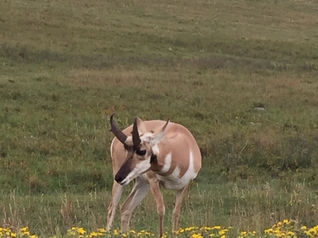
We cross through Buffalo, get on highway 16 entering the Bighorn National Forest. We see pronghorn in twos, threes, and more. Some of them are down close to the highway, in lush green fields stuffing themselves on grass. Now I’m wondering if the farmers here in Wyoming think of North America’s only antelope as a pest.
Just when you think you’ve left the most beautiful place on the planet, you roll up on something like Bighorn.
Still on Highway 16 we come to Meadowlark Lake, a recreation area built by the Civilian Conservation Corps in 1936. I’m reminded that two of my favorite uncles worked in the CCC in the years before World War II. They learned how to survey, build bridges, dams, and roads, and how to work hard, something they never forgot and always appreciated.
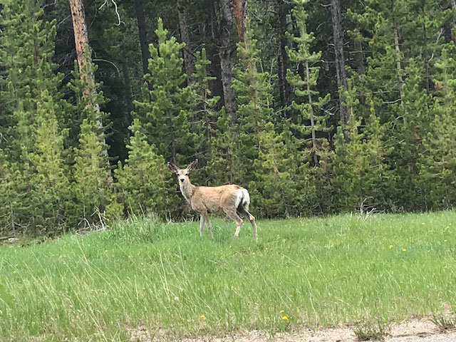
This Mule Deer doe looks on with disdain as we pass through her Bighorn home at 60 MPH.

Expanses of light green Aspen gleam against the darker Douglas Fir, cedar, and Lodgepole Pine, which flow up the sides of the mountains, while deer and elk peek out from the shadowed trunks. Nearly vertical stone cliff faces break the forest, and form horizontal bands of mottled ocher and gray. Beetles have killed what seems to be about half of the still standing pines, giving the forest a greenish-gray color, and reminding us that wild lands change with or without us humans.
Tensleep Canyon takes over as my Most Beautiful Place On The Planet. The walkway at Edisto Beach State Park in South Carolina had held that position for 20 years, so that’s no small recommendation.
Below is Tensleep Canyon. Read the marker beneath to see its significance, other than take-your-breath-away beauty.

Looking east up Tensleep Canyon.
Note to wife, Merrie: For my birthday, this is what I want!
We pass through Dubois, one of those little western towns with wide streets and an “enthusiastic” police force. We are giving special attention to keeping the speed limit, when we pass, well, nothing. With the exception of this:
Standing tall in front of a sporting goods store, this may be the world’s largest rod and reel.
In South Carolina we have some characters, but Ron, here in Wyoming wins the Best Sign Award. I wish I could have gotten a photo of it, but Mike had just gotten the Cadillactica back up to speed, when we flew past, “Ron’s Fireworks and Minnows.” Now I’m no expert, but wouldn’t fireworks go better with “Bandages & Hearing Aids?”
Completely worn out from the long drive, we finally reach Togwotee Lodge. No, even after asking the desk clerk, I have no idea how you pronounce it. However, to the local Native Americans Togwotee means, “You can go anywhere from here.” It was also the name of one of their chiefs. I suppose that’s a little like where our politicians plaster their own names on bridges and interchanges. If you are unfamiliar with Togwotee, look at a map of Wyoming. Hard up against Montana, above and slightly east of Jackson, just below Yellowstone National Park in the Bridget-Teton National Forest is Togwotee.
Tomorrow the Tetons. Brace yourselves, it gets even better.
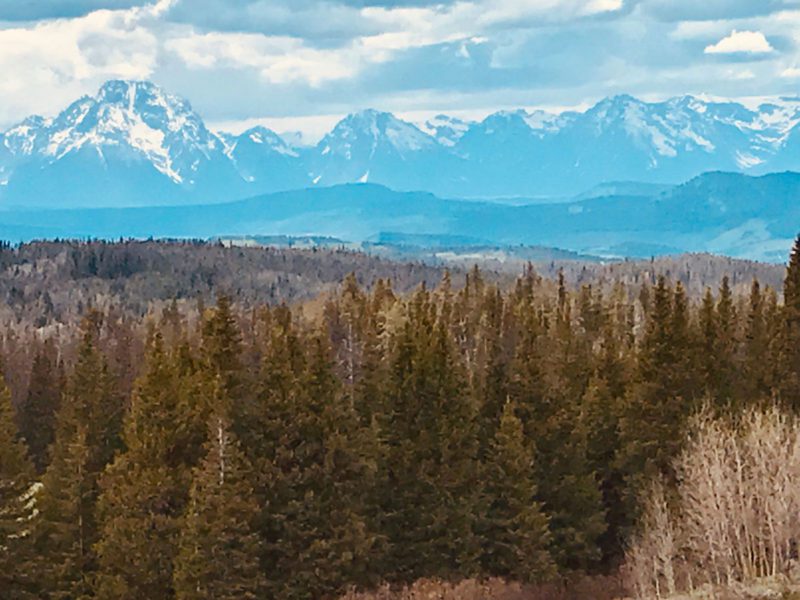
From Togwatee, we can see the Tetons looming in the distance!
Dispatch 6, June 12, 2019
The Black Hills, Devil’s Tower, Deadwood and Wild Bill Hickok

Cue up the music from “Close Encounters Of The Third Kind.” Today, we’ve programmed the Battlecar Cadillactica to land at Devil’s Tower.
But first, we’ll saunter up Interstate 385 passing through Deadwood, that South Dakota town known for the demise of one Wild Bill Hickok, drover, wagon master, soldier, spy, lawman, gambler, and gunfighter. He was also something of a showman. Think of today’s entire journey as something akin to “Cowboys & Aliens.”
Having left Hill City at 10:00 am, we zip through the Black Hills like a UFO on steroids. Gravity does not exist. The Cadillactica’s 420 horsepower engine and 10-speed automatic let it pass loaded logging trucks pulling loaded logging trailers like they are bound by the last century.
We’re hardly out of town when sister Pat nearly screams, “big, big, giant deer!” I never saw it standing majestically on the side of the steep, forested hill, but if I had to bet, I’d say she saw an American Elk.
We also see deer, Pronghorn, cattle, sheep, and a dead porcupine. Very dead. We pass a roadside theme park with a sign that reads, “Giraffic Park,” (no, I never saw the first giraffe) then what has to be the world’s largest rocking chair. It appears to have a full size deck where the seat should be. That tells me these Western South Dakota boys have an oddball sense of humor. Now I know where Sporting Classics editor Chuck, born in this part of the world, got his.
We reach Deadwood, one of those quaint western towns that is slowly being taken over by the worst of villains: tourist shops. My thoughts wander. I’m not sure Wild Bill had it coming in 1876. He was only 39. Some bastard shot him in the back of the head through a plate glass window. That’s a sorry way to leave such a beautiful place. Bill was holding two pairs, aces, and eights, which later became known as a “dead man’s hand.”
We pass through Spearfish. Then wander off the Command Console’s guided path to Devils Tower by rolling up on Belle Fourche (Foosh), Why? Because in 1929 the US Coast and Geodetic Survey used some kind of old math to determine that Belle Fourche is located in the exact center of the USA. And now, they have this giant slab of concrete, or polished marble, or whatever it is, to prove it. They also have the Tri-State Museum, which features cowboys, rodeos, pioneers, mercantile and military exhibits, information on local fossils, archeology, and geology. If you ever pass through this area, you’ll find it absolutely worth the stop.
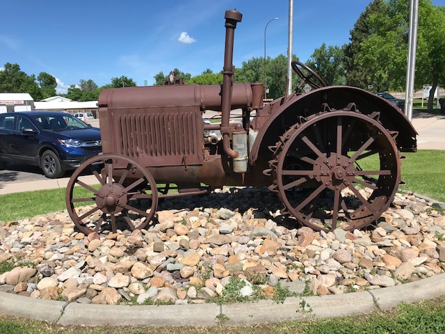
Old tractor at the Tri-States Museum in Belle Fourche.
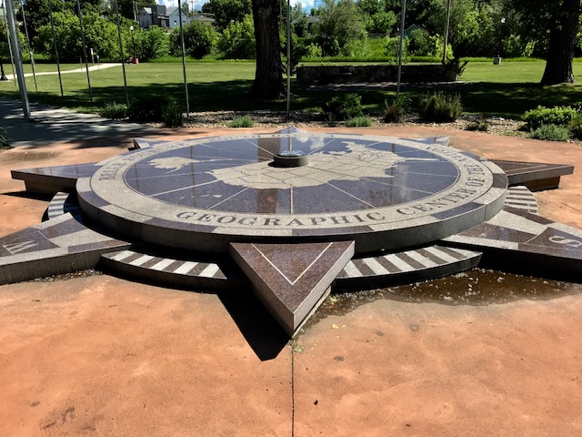
Center of The Nation Monument at Belle Fourche behind the museum.

Medallion in the center of the monument.
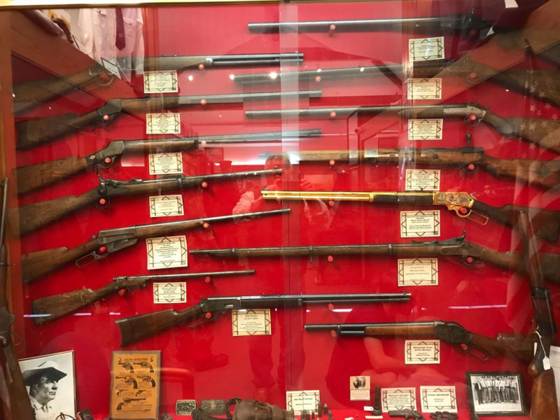
Military firearms collection in the museum.
After 45 minutes we are back aboard the Cadillactica, rocketing along. We laser past a small sign that reads: “Entering Wyoming.” This is the real west. Horses, big hats, boots, and honest to God Native Americans. Another small sign reads, “Alliance, population 15.” Right on the spot I decide that, when I come back, I want to trade some of these handsome looks for 4,000 acres on a great trout stream in Wyoming.
Then, far in the distance, it’s sticking out of the ground like a solitary, giant fang. Nothing can prepare you for it. The Indians were right: it’s an awe inspiring mystical experience. I take a hundred photographs with my iPhone and my Nikon, but cannot capture it. Color seems to divert attention away from its presence. So I make one in black and white. On a comfortable bench, I sit down in front of it and I swear I think I can feel it. It fills your view and makes you wish you could have been there to watch the very first human lay eyes on it.
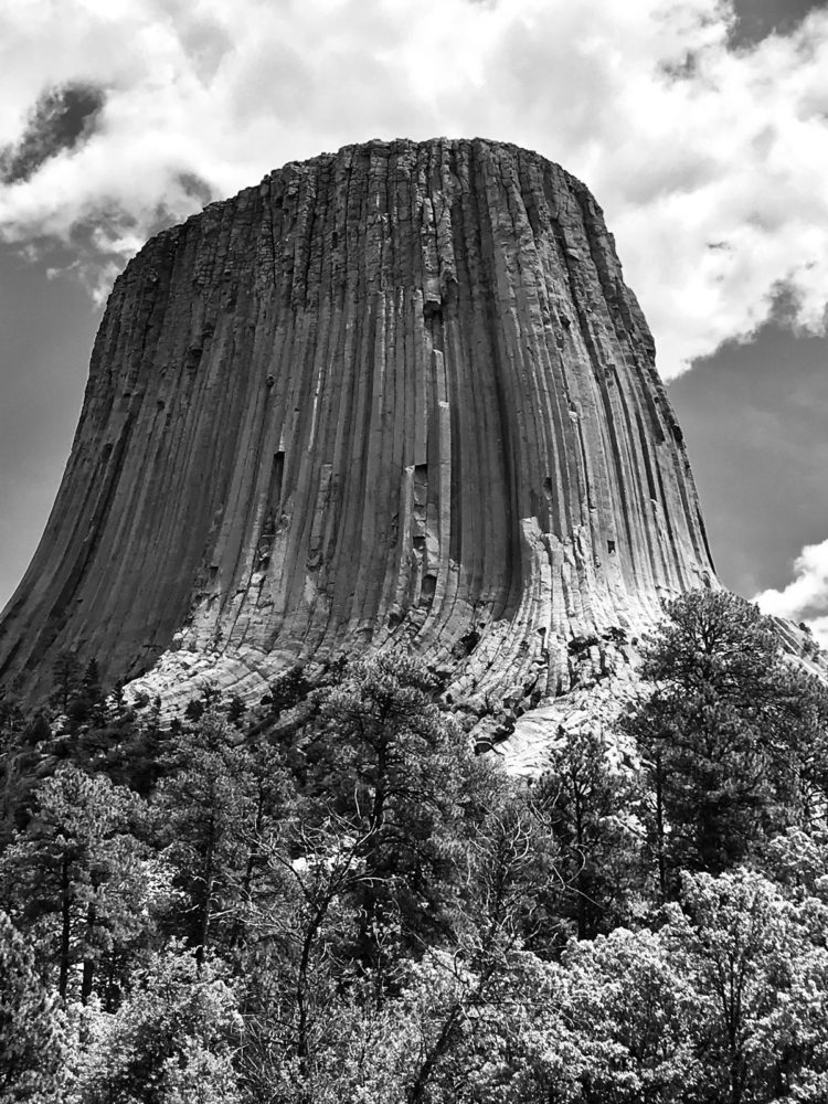
For those who’ve never experienced an earthquake, tornado, or hurricane, Devil’s Tower is a reminder that there are powers much bigger than us controlling our survival.
We’ll get an even bigger dose of that when we reach Yellowstone.
Dispatch 5, June 11, 2019
We are up early this morning, jetting along toward South Dakota’s Custer State Park in the Black Hills. It may be steaming back home in South Carolina, but it’s forty-eight degrees and cloudy outside the bug encrusted Caddilactica.
We enter the park and begin our tour through what appears to be some of the most beautiful country in the world. This place is as green as Ireland, and strewn with weather rounded boulders that appear to have been put in place by set designers for a Hobbit movie. Buffalo graze the grassy hillsides, deer glide almost unseen through the pine and hardwood forests, and the occasional Pronghorn strolls along, or beds down under the big sky open areas, unafraid this time of year. Elk, Mountain Lion, and Turkey roam the park as well. Ponds and lakes fill low lying areas with clear, dark water and streams connect the ponds by dodging giant boulders and falling down steep rock-strewn courses. The park does allow hunting in the fall to keep the game populations in check. And for any bureaucrats reading this: the South Dakota Game, Fish and Parks Department does a fantastic job of running this astounding place, which in any other place might be a federal park.

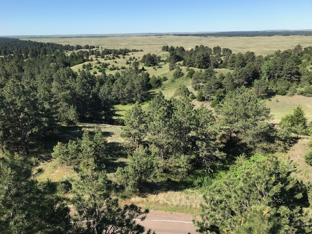
Soon after entering the park we pass tranquil Stockade Lake and my fly casting muscles begin to itch. But I have no license yet, and I have to remember that this is a family vacation, so we proceed on. We begin the climb up Mt. Coolidge to get a look at the world from 6,023 feet. The vista is overwhelming. However, someone has turned the pinnacle into a porcupine of towers and ugly guy wires. Still, between the wires I get some very nice photos. And, of course, I can make a call or check my email from almost anywhere on the park. Hopefully, the park makes a lot of money from them.
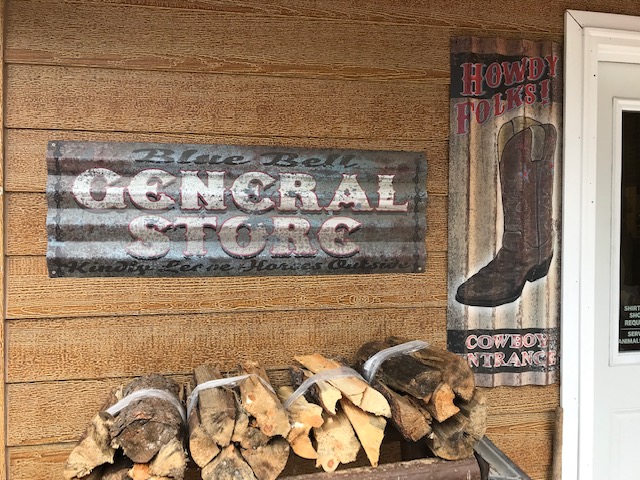
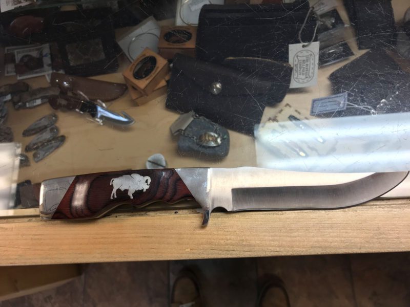
We continue traveling southeast on Wildlife Loop Road, stopping at various parking spots to watch Prairie Dogs, Buffalo and other animals when we come to the Blue Bell General Store. Inside you can find most of the needs of campers, hikers, and visitors. You can buy a very nice hunting knife with an American Bison inset into the handle for $132, which I thought was a bargain, or a pack of cigarettes for $12. Having never smoked, I’ll take the knife!
Turning north and traveling up the southeastern side of the park we come to the Wildlife Station Visitors Center. It has displays of Rocky Mountain and the now extinct Badlands Bighorn Sheep. A huge Elk graces the fireplace of this building which used to be the home of the park’s herders. Continuing north along Iron Mountain Road we take in the beautiful scenery that is so different from that where we live.

We eat lunch at the Game Lodge. Having had one bad experience at a restaurant in Georgia a few years back, I pass on the Buffalo and try the chicken pot pie. It is delicious and so filling that I was still not hungry at dinner later in the evening. From the Game Lodge we drive up to Hill City to check in to our hotel and unload the car.
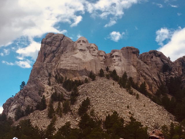
After unloading, we drive up to Mount Rushmore to see the famous stone carvings of George Washington, Thomas Jefferson, Theodore Roosevelt, and Abraham Lincoln. We approach the monument by driving through one of the carved stone tunnels where we first glimpse a work that took sculptor Gutzon Borglum and his son Lincoln from 1927 until 1941 to complete. At the monument, flags of each state hang over the impressive entrance. It is awe-inspiring to say the least.
We leave Mount Rushmore and head south again to see the Needles along Needles Highway. As luck would have it, it’s raining. We head out anyway, hoping the rain and clouds do not last.

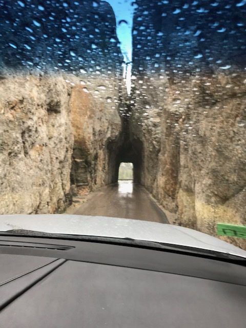
The road snakes back and forth, and through the fog we can see bizarre, gray stone spires towering, in some cases hundreds of feet high. The needles are juxtaposed against a huge variety of greens, from dark to chartreuse, in the trees, leaves, shrubs, and grass. As we approach the rock forms, the rain falls even harder. I can’t roll down the window without getting soaked. Taking photos is nearly impossible and extremely disappointing. But I try to be positive by saying, “if the rain clears and the sun comes out, you are not going to believe the colors.” We squeeze the Cadlillactica through the tightest of carved rock tunnels and turns, and every time we do it, the scenery gets even more incredible. Then, miraculously, the sky turns the brightest blue and the sun shines down, lighting the stone spires like church steeples. Even though for the sake of expediency the ones you see here were taken with my iPhone rather than my big Nikon, I hope you enjoy the photographs. We certainly enjoyed taking them!

Dispatch 4, June 10, 2019 Custer, Nebraska
With Grand Island, Nebraska in the rearview mirror, we brought the Cadillactica up to warp speed, setting the dials for the Black Hills and South Dakota’s town of Custer, where a state park shares the General’s name.

Stop for gas and you’ll find everything you need to survive in Nebraska: Guns, knives and fish bait.
It’s 51 degrees as we hurry westward on Highway 2. We pass cattle farms, tractors, and gigantic semis. Train after long train, some 15 at least, each pulling more than a hundred cars loaded with coal, travel east on the rails paralleling us. Most of the roads are arrow straight passing fields watered by those giant pivoting irrigation systems. Occasionally, however, I can also see old farms with ancient windmills spinning, filling concrete stock tanks like those I saw in Namibia. I wonder if deer come to them at night the way Gemsbok did in Africa.
We turn north on 385 at Alliance and eventually cross the Loup River, gradually climbing to 2,000 feet above sea level. The land becomes more hilly and is patched with stands of hardwoods along fence lines and in low areas. I’m trying to spot deer among the wind-blow leafy trees when, sadly, I see one lying dead beside the road.
View from the top of Scott Lookout Tower.
Farther down, we see our first Blue Spruce trees, and two determined fishermen braving the Nebraska wind, fishing what appears to be a ten-acre pond. I’m jealous, and wonder what kind of fish might bite is such a gale.
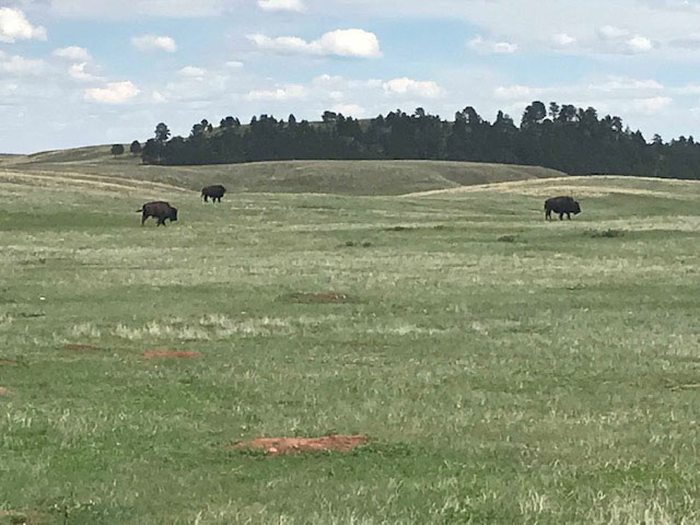
We see our first American Bison just south of Custer, SD.
The Dismal River (I love that name), runs to our left, and the Middle Loup to our right. As we reach more than 3000 feet in elevation we see signs for the Nebraska National Forest and Scott Lookout Tower. There, the old fire tower looms, it’s solid stairs begging to be scaled. Signs warn about not climbing in lightening storms, or if you are under 18. I take that as a “yes,” hang my Nikon on my shoulder, and it is Legs Day at the gym. Not a bad climb at all, and I get some nice photographs of the surrounding lands and forests.
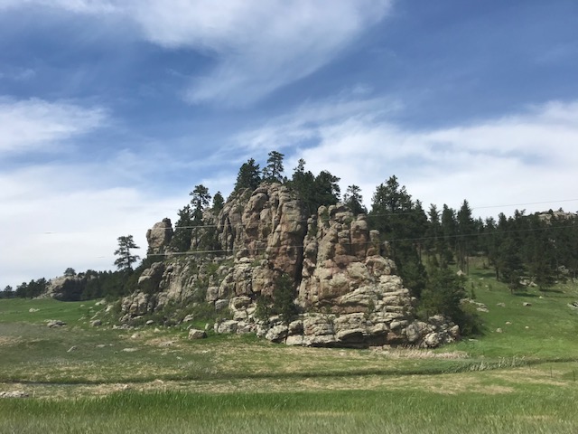
Near Custer, South Dakota.
We follow 385 north and begin seeing Pronghorn Antelope on the sides of the hills. Some are right down near the road feeding on the greener grasses.
In Grant County, north of Hyannis, we pass the small town of Ashby, Nebraska. I am startled to catch a glimpse of what appeared to be dirt streets. Someone who lives in that area please let me (duncan@sportingclassics.com) know, so I can put Ashby on my bucket list of places I‘d like to visit.
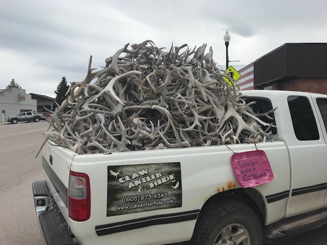
Truck parked in front of Claw, Antler, & Hide in downtown Custer, SD.
After another day of hard driving it’s nice to finally get to our hotel in Custer, visit the town, and get some dinner.
Frankly, however, I’m surprised that today’s PC hordes have left Custer’s name intact on buildings, counties, and parks. He was dead last in his 1861 graduating class at West Point, earned some street cred for bravery in the Civil War, then got the custard kicked out of himself and his men by Sitting Bull at Little Bighorn.
Tomorrow, we’ll visit the park.
Dispatch 3, June 9, 2019 Grand Island, Nebraska
We left Kansas City this morning steering the Battlecar Cadillactica in the direction of the Missouri River Basin Lewis and Clark Interpretive Trail & Visitor Center near Nebraska City, Nebraska. The Center is located next to the Missouri River Bridge on Highway 2.

In the distance, the flooded Missouri River flows over Interstate 2 just below the Misssouri River Basin Lewis & Clark Interpretive Trail & Visitor Center near Nebraska City, Nebraska.
When we arrived, the bridge was closed just beyond the entrance to the Center due to extreme flooding in the river basin. The Center was open however, and well worth a visit especially for history buffs.
If you’ve not read about Lewis and Clark’s Corps of Discovery, it was commissioned by Thomas Jefferson after the Louisiana Purchase to learn about “water communication across this continent for the purpose of commerce.” It was an absolutely fascinating, and at times, harrowing adventure.
Entrance to the Missouri River Basin Lewis and Clark Interpretive Trail & Visitor Center
The Center features Native American artifacts from the area, a replica of the Corps’ keelboat, American Bison, Elk, Grizzly Bear and the fish they caught. Displays provide detailed explanations of every facet of their journey which officially began May 14, 1804 in Illinois, reached Oregon’s Pacific Coast in November 1805, and returned to Washington DC in the fall of 1806.
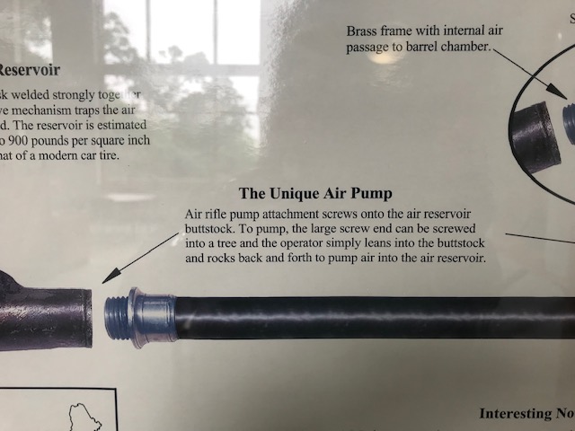
Detail about Lewis & Clark’s airgun:
Of particular interest to firearms aficionados would be the air rifle that the explorers took with them. Built by Philadelphia clockmaker and gunsmith, Isaiah Lukens, the .31 calibre rifle was capable of firing 20 to 40 times before being recharged by the air pump. The explorers used the gun to kill big game for food, and to intimidate hostiles into having better manners.

Mounted Elk.
After visiting the Center for an hour or so, we saddle up the Cadillactica and gallop west to Grand Island, Nebraska for the night. Tomorrow, we are off to Custer State Park, 423 miles away near Custer, South Dakota. See you there!
Dispatch 2, June 8, 2019 Kansas City, Kansas
We left Paragould this morning at 9:00 am driving hard out of Arkansas, on to Missouri, then into the edge of Kansas at Kansas City.
The Cadillactica is flawlessly gobbling up the miles, it’s beast of a 6.2 liter engine sucking up gasoline like it’s 1954. However, since the driver’s manual is missing, we’ve not yet figured out how to set the auto speed control. I’m sure it’s there somewhere amongst the dozens of buttons, slide bars, and gizmos. No, those near the tiny speedometer-like ikons seem to do nothing. Also, note to the geeks who designed the info center: Next time, please put the damned destination delete button next to the destination, not four levels away!
Bugs have gummed up the windshield, we’ve run out of cleaner, and there’s not a Walmart (nor much else) in sight!

Missouri seems to have a huge selection of antique shops and flea markets. This one had a bicycle fence surrounding it. Second from the right is a reminder of the Sears bike my aunt and uncle gave me for Christmas, 1960. If the fish don’t bite, I want to come back here.
The countryside is beautiful, (at least through the side windows) though flooded by recent rainstorms. Rivers and lakes are out of their banks. Parts of low lying agricultural fields are knee deep in water. My bet: the price of cornflakes is going up.
We’ve also seen plenty dead whitetail deer along the highways. Perhaps they’ve been pushed to higher ground by the rising waters too. And, in a place with so many waterways we’ve only seen one fisherman. He was in a boat on a small pond. Everything else has debris pushed up among trees many feet above the usual high water line.
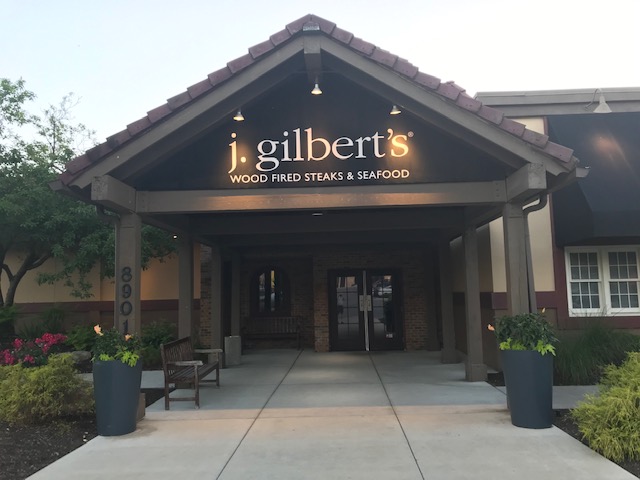
J. Gilbert’s in Kansas City, Kansas. Big wine list, great steaks, and one of the tastiest things I’ve ever put in my mouth.
We made Kansas City about 5:30 pm, and got settled in our hotel rooms. Staff at the Hampton Inn suggested dinner at J. Gilbert’s a mile or so away. The steaks (salmon for Pat) were perfect, so Kansas City certainly lived up to its reputation. However, the little side dish of cream corn with bacon was one of the best things I’ve ever eaten, falling only slightly behind the gemsbok that I killed, host Donnie Van Vuuren grilled, and my son George and I ate in Namibia.
We’re already a long way from South Carolina, Toto, but morning will find us moving ever-westward, this time toward Lincoln, Nebraska and the Lewis And Clark Interpretive Center where we hope to discover more about one of the original Great Western Loop Tours.
But first, that windshield cleaner!
Dispatch 1, June 7, 2019 Paragould, Arkansas
This is where Sporting Classics Publisher, Duncan Grant, his wife Merrie, along with Duncan’s sister Pat and brother in law Mike Dukes, drive from South Carolina to Yellowstone Park, Henry’s Lake, Glacier National Park, and much more, something we’ve wanted to do for years. We are hoping we get to fish along the way, and that our house-sitting children take good care of Jax, my wife’s Norwegian Reliever (a fluffy white dog that urinates on expensive Oriental carpets!) Okay, it’s a MaltiPoo. Yeah, I know.

The Battlecar Cadillactica, as we’ve named it, finally loaded up early Friday morning.
To get there, we’ll have to brave flooding along the Missouri and Mississippi Rivers, tornadoes in the center of the country, earthquake swarms, and the steaming volcanic caldera of Yellowstone itself, then, most dangerous of all, June tourist traffic.
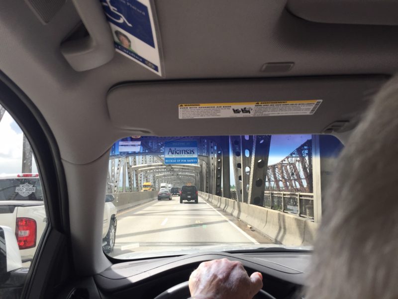
The Mississippi Bridge near Memphis, waters rising rapidly below. My white knuckles gripping the wheel:
First night, we made it to Paragould, Arkansas.
After having spent days packed into a giant rented Cadillac Escalade, will we hate each other by the time we get back? Will the fish bite? Will the fly rods survive hellacious roads and confusing directions? Will we even be able to find Yellowstone?
Stay tuned.